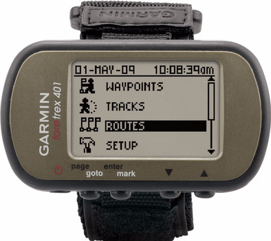
Garmin Foretrex 401
Never available again
View alternatives in the sidebar
View alternatives in the sidebar
According to our hiking navigation system expert
Looking for an accurate navigation system for your wrist? Perhaps the Garmin Foretrex 401 meets. With this walking GPS you always know where you are and which route you have walked. The device leaves behind a digital crumb trail, so you know exactly how and where you walked. Use the barometric altimeter to see at what height. If you have not set waypoints, you can easily navigate with the 3D compass. Here you can feel free to do something about. The device operates on 2 AAA batteries that last 17 hours. With the Foretrex 401, race sailors and paragliders are also at the longest end. The special competition software provides timely instructions and ensures a flying start.
Color screen | ||
|---|---|---|
Type of altimeter | GPS | |
Built-in camera | ||
Compass | ||
Water-resistant |
5 stars
4
4 stars
5
3 stars
1
2 stars
0
1 star
0
After a few weeks of experimenting with the device and of course a lot of trial and error, I became increasingly convinced of the correctness of my choice. The foretrex is perfectly suited for the versatile outdoor athlete. I have tested this device while walking and running as well as with the mountain bike and it worked perfectly in all situations. Even in foggy weather. The only condition to use all the possibilities of this device optimally is that you have a good basic knowledge of orientation (be able to work well with map and compass) as the device only does what the GPS was designed for in the first place. Namely HELP you navigate. You can't load maps in it and personally I don't think this is necessary because I always take paper maps with me on the terrain. Even though the batteries last a very long time! Which is a minus; If you think you don't have to buy digital cards now, you're wrong. If you want to work with mapsource or basekamp (which is damn handy) you still have to buy (expensive) maps. This is because by default there is a very little detailed map with which you as an outdoor athlete cannot do much if you want to plot routes on PC and load them into your GPS. You can work via google earth and a converter and put everything in your gps, but all this is quite cumbersome. By the way, the GPS device opens as a mass storage device on your PC when you connect it. This makes it very easy to drag GPX files (GPS Exchange file) stored on your PC into your GPS. Conclusion; A perfect device if you practice a lot of sports and have a good knowledge map and compass. Optionally expandable with a heart rate sensor and a cadence meter.
Jeroen
12 March 2012
Automatically translated from Dutch
After a lot of deliberation, I chose the Foretrex 401. Initially I wanted a GPS system with map, but further research showed that maps are extremely expensive. In addition, most GPS systems, except for the Edge, turned out not to be particularly suitable for mountain biking, which can sometimes get rough. The goal for me is not to cycle the standard paths, but to map out beautiful routes yourself, find your way to the next point and find your way back (or back to your hotel) if you start looking for the beautiful paths yourself.
The E-trex had my initial preference, but the attachment for the bike turns out to be weak and not suitable for rough descents (as evidenced by reviews and are also the words of Garmin itself at the bike fair). The Edge is more intended for cyclists who specifically pay attention to performance and does not have a digital compass which is a requirement for me. The Oregon is far too expensive and the Dakota does not have a super strong screen, according to several reviews. Moreover, a touchscreen on the mountain bike is not useful when you ride in the mud. The GPS 60/62 is quite large and also expensive but very solid.
The only downside of the Foretrex is the lack of a map mode. I dropped that point because all those very beautiful singletracks in the Eifel where no one comes are not indicated on the map either, you have to discover them yourself.
The reason for choosing the 401 instead of the 301 is purely because it has a digital compass and an altimeter. Very useful for mountain biking.
In addition to the Foretrex, I also seriously looked at the O-synce NAVI2. Nice device with almost the same possibilities (but cheaper than the Foretrex) where you can easily create your own routes in Google Earth and upload them. The disadvantage of the O-synce is that you can only have 1 route in the device at a time. After some research I discovered a tool (ge2gpx) with which you can create routes yourself in Google Earth and upload them in Garmin Basecamp, from where you can upload them again in the Foretrex. This works perfectly! Moreover, you can save 20 routes at the same time on the device, so if you go into the Eifel for a few days, you don't have to take your laptop with you to create routes, you can already do that at home.
The Foretrex itself is very easy to operate. If you know a little bit about how navigation should work, you don't need a user manual at all. Everything is intuitive. The only thing I had to look for is how the lighting works (short press the on/off button) and that was not in the user manual, but that should not spoil the fun.
The Foretrex has clear screens and menus where you can arrange the screens completely according to your own wishes and add or remove items. Everything you need can be found, including a blank dotted map with the road travelled, a line to your next waypoint and the remaining waypoints. The scale is adjustable from 0.5 to 500 km.
The navigation works perfectly. When creating a route you should be careful not to create too many waypoints but only make crucial intersections because otherwise you will pass a waypoint every few minutes and you will only be looking at the screen. Enjoy cycling!
Furthermore, the device is solid, small and handy. It comes with a wrist strap and you can use it as a watch (useful for hikers, horse riders and skiers). I myself have it with an old watch mount on the handlebars and that's fine. If you fall, you don't have to worry that the Foretrex will break, it can take a beating.
The screen is clearly legible, buttons are easy to operate and operation is self-explanatory. Another big advantage is that the device works on standard (rechargeable) AAA batteries. Another advantage compared to the O-synce because it works on an internal battery that can only be charged with USB. Moreover, the batteries easily last 18 hours. If you think you're short of these, put a few spare batteries in your pocket...
You can also connect a heart rate monitor and a cadence sensor, but I don't need that.
During the ride you can easily skip waypoints or, for example, go directly to your final destination. If you want to cycle back exactly the same way, switch on the backtrack function and it will take you back to the starting point via the same route. You will also find all data about speeds, distances, heights, etc. in all possible forms.
After the ride, you connect it to your computer and you can download the route you drove again and view it on Google Earth, for example.
In short, great thing for mountain bikers and other outdoor enthusiasts!
Arno Bekker
4 November 2010
Automatically translated from Dutch
Product suits very well. Especially for military work where you have to walk several coordinates! The device is accurate, and works on batteries, so you can get back to work right away if you replace it!
Dekker
5 July 2016
Automatically translated from Dutch
Product number | 98552 | |
|---|---|---|
Manufacturer code | 010-00777-00 | |
Brand | Garmin | |
Warranty | 2 years | |
Processing of your defect | Carry-in warranty |
Height | 7,5 cm | |
|---|---|---|
Width | 4,3 cm | |
Depth | 2,3 cm | |
Weight | 0,0873 kg | |
Color | Green | |
Built-in camera |
Screen size | 1,7 inch | |
|---|---|---|
Touchscreen | ||
Color screen |
Global satellite navigation system | GLONASS, GPS | |
|---|---|---|
Quick GPSfix | ||
Trackback feature | ||
Tracklog points | ||
Uploading routes possible | ||
Useful places | ||
Geocache function | ||
Compass | ||
Altimeter | ||
Type of altimeter | GPS | |
Tide tables | ||
Recommended for activity | Hiking, [Watersport] |
Pre-installed maps | ||
|---|---|---|
Maps expandable |
Compatible with smartphone / apps |
|---|
Total storage capacity | 0 GB | |
|---|---|---|
Memory card reader |
Power supply type | Rechargeable battery | |
|---|---|---|
Battery technology | Alkaline | |
Maximum battery life | 17 hours |
Water-resistant | ||
|---|---|---|
IP certification | IPX7 | |
Water resistance | Waterproof | |
Dustproof |